Community engagement: Using digital tools for greater public understanding
23 June 2020
SHARE

Successful engagement begins with clear communication of the issue, and an easy way for stakeholders to give feedback.

Traditionally, councils and consultants relied on a simple, yet incredibly effective way to gather opinions and feedback about potential changes to a community’s environment: Post-It Notes and a large map. With users writing comments and sticking them onto the relevant part of the map, it was an easy and intuitive way for people to get their ideas across.
Interactive digital mapping takes that idea one step further: it’s more precise than sticky notes on a paper map, and people can access and interact with the map at a time that’s convenient for them — there’s no need to attend a scheduled engagement session. It’s one of the most effective ways to engage with community and stakeholders online.
The basis of these maps is Social Pinpoint, an online engagement tool and interactive mapping platform that enables users to click-and-drag a locator pin and add comments, showing exactly where their feedback, ideas and concerns relate.
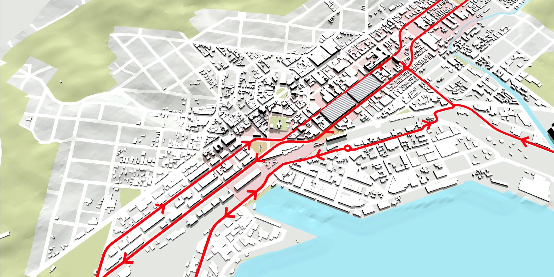
Social Pinpoint has been used by the designers and engagement specialists in our Dunedin office for the public engagement on the Shaping Future Dunedin Transport project.
The team used the project to take interactive mapping to the next level on behalf of our client, Connecting Dunedin – a partnership between NZTA, Dunedin City Council and Otago Regional Council.
“Initially we had created 2D maps to illustrate three potential scenarios for the transport network,” says Emma Taylor. “But then we considered creating the maps in 3D to make them easier for the general public to understand.”
The process used standard software: Adobe Illustrator, AutoCAD and Infraworks.
“AutoCAD ensured that all our linework was geo-referenced in the right places,” says Emma. “Infraworks allowed us to create a 3D model that the user could ‘fly-through’ and we laid the various transport options over the top.”
“Social Pinpoint is a great tool, but it’s normally based around two-dimensional maps,” Emma explains. “We had to figure how to get the 3D maps to work, so we turned the elements into a series of images and explored the idea of geo-referencing them.”
This was done using Illustrator, Map Publisher, and Map Box to interface with Social Pinpoint. The team had a few challenges along the way: the line work showing the transport options wasn’t sitting properly on the 3D map.
“We’d come so far, and we knew it would could work, we just had to think outside the box. So, we ended up moving the geo-reference points to a spot closer to the Equator — which effectively ‘flattened’ the 3D map, and it all fit together perfectly.”
The site went public on June 15, and to date visits to the site have been considerable. You can find out more about the project and access the Social Pinpoint site here.
For further information please contact Rachael Eaton or Emma Taylor