GIS analysis for residential intensification modelling
17 November 2021
SHARE

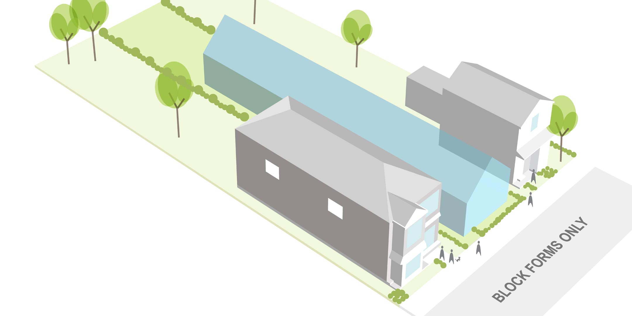
GIS and 3D modelling software can be used to examine proposed intensification measures; and reveal the planning measures and metrics that maintain an acceptable level of amenity.
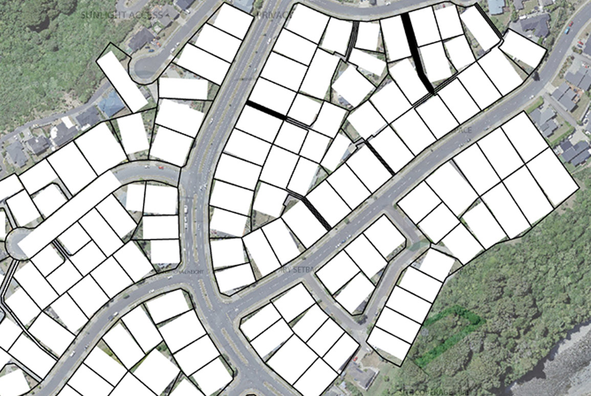
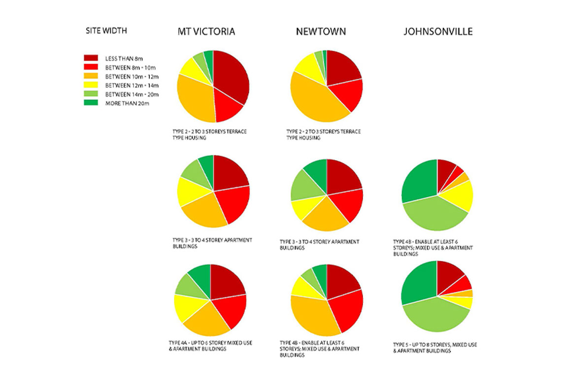
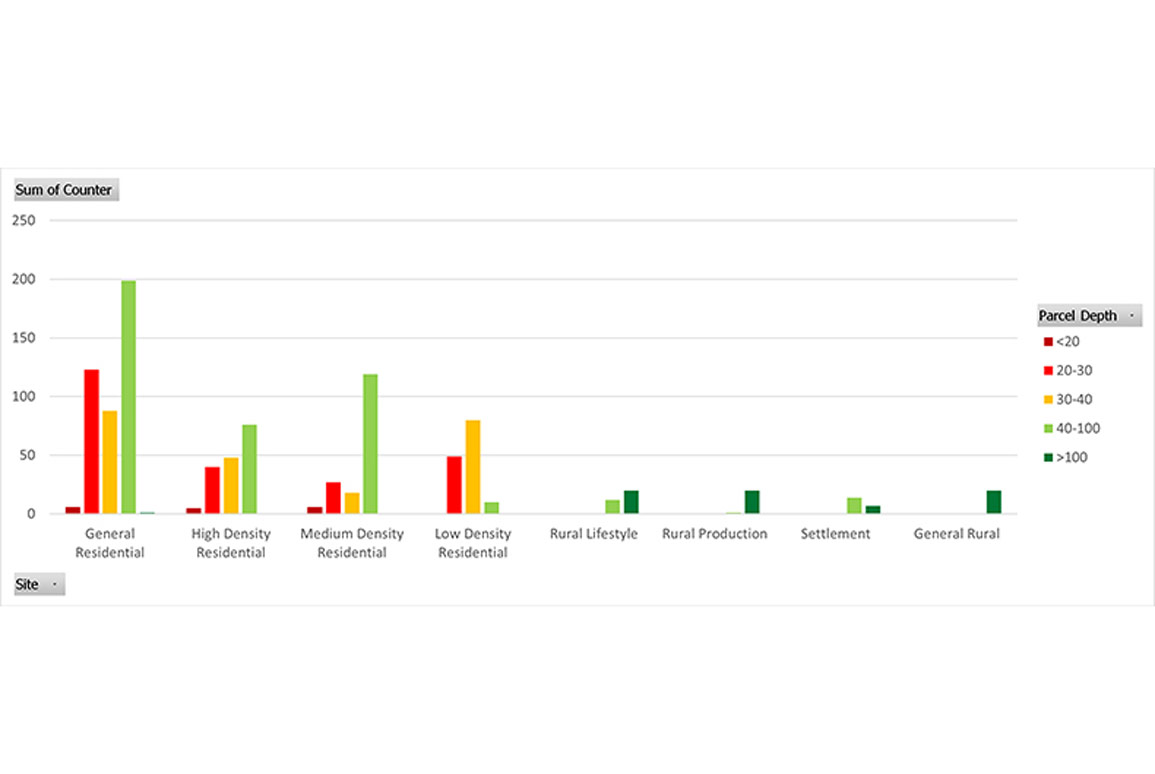
The Urban Design and GIS team in Wellington have developed a data engineering approach on the analysis of parcel width and depth to support analysis of residential intensification modelling on different housing density types.
The geospatial analysis finds out dimensions of the maximum-fit rectangle of each input property. The data is helpful for understanding the existing residential character and subdivision pattern, as well as indicating the typical site dimensions for further modelling work. Detailed statistics and graphs are included to support evidence base analysis.
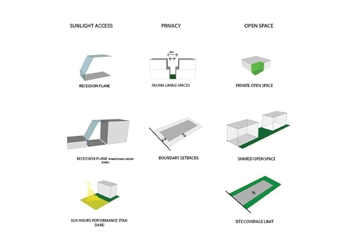
“The modelling focuses on residential amenity and measures that can be used to achieve a balance between amenity and the increased density envisaged by the National Policy Statement on Urban Development (NPS-UD)", says GIS specialist Kay Mak.
“The amenity attributes include open space, sunlight access, privacy and so on.”
This process has been completed for a number of local councils in the Wellington Region to date and could be used by local, regional or central government for analysis of potential intensification areas across the country.
Find out more
Planning for Residential Amenity
Supreme Success at the 2021 NZPI Conference